The shallow limestone bedrock and variable alluvial deposits across the Kansas City metro make seismic site classification a critical step before foundation design. Per IBC 2024 and ASCE 7-22, determining the average shear wave velocity in the upper 30 meters (VS30) is mandatory for seismic design category assignment. The MASW method, which maps subsurface stiffness by analyzing surface-wave dispersion, delivers this data efficiently without the access constraints of boreholes. In Kansas City, where the geology shifts abruptly from Pennsylvanian limestone to Missouri River floodplain, a properly executed VS30 survey often saves thousands in over-engineered structural components. The technique has become the standard for high-rise projects in the Crossroads Arts District and industrial expansions near the Fairfax District, where the seismic site class can vary by two categories within a single parcel.
In Kansas City, site class can shift from C to D within 100 feet, making high-resolution VS30 profiling a cost-saving necessity rather than an optional extra.
Our approach and scope
Local considerations
Kansas City's expansion from a river trading post into a bi-state metropolis has left a patchwork of engineered fill, cut, and natural ground. The West Bottoms and parts of North Kansas City sit on deep, compressible Missouri River deposits that amplify ground motion differently than the limestone uplands of the Country Club District. A uniform seismic design assumption across a multi-building development in these settings introduces hidden risk: two identical structures can experience fundamentally different ground shaking. The 2024 IBC now enforces site-specific VS30 determination for structures in Seismic Design Category D and above, and Kansas City's adopted building code mirrors this requirement. Skipping the survey or relying on generalized USGS proxy maps—which lack the resolution to catch buried valleys or pinnacled rock—can lead to spectral acceleration values that are either dangerously underestimated or wastefully conservative. For critical facilities, the VS30 data also feeds directly into the liquefaction assessment, particularly in areas with saturated sandy alluvium near the Kansas and Missouri rivers.
Video overview
Relevant standards
IBC 2024 (Kansas City adopted code), ASCE 7-22 Minimum Design Loads for Buildings, ASTM D7400 Standard Test Methods for Downhole Seismic Testing (referenced for VS profiling), ASTM D5777 Standard Guide for Seismic Refraction (complementary P-wave method), NEHRP Recommended Seismic Provisions for New Buildings
Associated technical services
MASW / VS30 Seismic Site Classification
Full 2D MASW profiling with dispersion curve picking, genetic algorithm inversion, and IBC/ASCE 7-22 site class mapping. Deliverables include VS30 contour maps and design spectra for structural analysis.
Combined Geophysical & Geotechnical Integration
MASW data cross-validated with borehole SPT N-values or CPT tip resistance for a unified subsurface model. Eliminates interpolation uncertainty between discrete boreholes.
Deep Shear Wave Velocity Profiling
Extended arrays for projects requiring VS data beyond 30 m, such as deep foundations, high-rise towers, or seismic isolation design where the impedance contrast at the limestone interface must be precisely mapped.
Typical parameters
Quick answers
How long does a typical MASW survey take for a Kansas City commercial lot?
For a standard one-acre commercial parcel in the Kansas City area, field acquisition with a two-person crew typically runs three to five hours, including setup, multiple array deployments, and demobilization. Processing and reporting add another three to five business days. Larger sites or those requiring multiple orthogonal lines—common in the Northland where paleochannels can be oriented unpredictably—may extend field time to a full day.
What does a VS30 survey cost for a project in the KC metro?
MASW / VS30 surveys in Kansas City generally range from US$1,550 to US$3,260, depending on line length, number of array deployments, and reporting complexity. A single residential lot survey falls at the lower end, while a multi-line commercial site with 2D cross-sections, site class mapping, and design spectra sits at the upper end. Mobilization within the metro is included.
Can MASW work on pavement or in urban areas with high background noise?
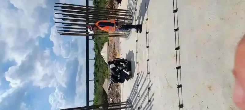
Yes, the method adapts well to Kansas City's urban environment. We routinely deploy on asphalt parking lots and closed streets using base plates that couple the geophones to the pavement surface. The active-source sledgehammer signal stacks efficiently to overcome ambient noise from traffic and adjacent construction. In particularly noisy settings—downtown near the Power & Light District, for instance—we extend the stacking cycles and sometimes shift to night-time acquisition when background vibration is lowest.